When All Continents Were One: Continental Drift Theory
 By Narendra Dwivedi
6 July 2026
•
15 min read
By Narendra Dwivedi
6 July 2026
•
15 min read
TL;DR
Around 300 million years ago, Earth's continents formed one giant supercontinent called Pangaea, surrounded by the superocean Panthalassa. German meteorologist Alfred Wegener proposed the Continental Drift Theory, supporting it with evidence such as matching coastlines, fossils, rocks, glacial deposits, and mineral deposits. Although his explanation of continental movement was incorrect, later discoveries including convection currents, sea-floor spreading, and plate tectonics confirmed that continents do indeed move.
Open a world map and look closely at the continents for a moment. Africa stands separated from South America by the vast Atlantic Ocean. Europe lies above Africa, Asia stretches across the east, while Australia appears isolated in the Southern Hemisphere. It seems so natural that we rarely question whether the Earth has always looked this way. But what if the map we know today is only a single frame in a story that has been unfolding for billions of years? At first glance, some coastlines appear strangely familiar. The eastern edge of South America seems as though it could nestle against the western coast of Africa. North America and Europe also share curious geological similarities despite being separated by thousands of kilometers of ocean. Are these merely coincidences, or are they clues left behind by Earth's distant past? Today, we know these similarities are not accidental. They point to one of the most revolutionary ideas in physical geography, that the continents were once united and have slowly drifted apart over millions of years.. This idea became known as the Continental Drift Theory, forever changing how we understand our planet.
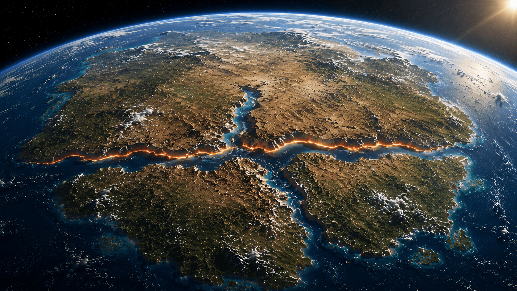
A Time When Earth Had One Giant Continent
If we could travel back roughly 300 million years, the Earth would be almost unrecognizable. Instead of seven separate continents, there existed a single enormous landmass known as Pangaea, a name derived from Greek words meaning "all Earth." Nearly every major continent that exists today was connected, forming one vast supercontinent that dominated the planet's surface. Surrounding this colossal landmass was an equally enormous ocean called Panthalassa, meaning "all sea." Unlike the modern world, where the Pacific, Atlantic, Indian, Arctic, and Southern Oceans divide the continents, Panthalassa formed one continuous superocean that stretched around Pangaea. Imagine standing on a shoreline where the same ocean extended for thousands of kilometers in every direction, wrapping around almost the entire planet. Life on Pangaea was very different from today. Animals and plants could migrate across immense stretches of connected land without encountering the oceans that now separate continents. Regions that are oceans today were once forests, rivers, mountains, and deserts, while many landscapes familiar to us had yet to exist. The Earth was not simply arranged differently—it was an entirely different world.
The First Great Division of the Supercontinent
Like everything in nature, Pangaea did not remain unchanged forever. Over millions of years, the supercontinent began to fracture. The first major split divided it into two gigantic landmasses. The northern portion became Laurasia, also known as Angaraland, which included what would later evolve into North America, Europe, and much of Asia. The southern portion became Gondwana, or Gondwanaland, consisting of present-day South America, Africa, Antarctica, Australia, the Indian subcontinent, and Madagascar.
Between these two enormous continental masses lay a long, shallow body of water known as the Tethys Sea. Although it may have appeared to be just another sea, it played a pivotal role in Earth's geological history. As millions of years passed, the continued movement of these continental blocks reshaped oceans, created new coastlines, and eventually contributed to the formation of some of the world's greatest mountain ranges.
The breakup did not happen overnight. Continents do not move at the speed of storms or earthquakes. They shift so slowly—only a few centimeters each year—that the motion is impossible to notice within a human lifetime. Yet over tens and hundreds of millions of years, these tiny movements completely transformed the face of our planet, producing the continents and oceans we know today. This naturally raises an intriguing question. How did scientists discover that continents separated by vast oceans were once part of a single giant landmass? More importantly, what evidence convinced them that this extraordinary idea was more than just imagination? The answer begins with an observant German meteorologist who noticed something on a map that countless others had overlooked.
Alfred Wegener: The Man Who Asked an Uncomfortable Question
The idea that continents move may seem obvious today, but in the early twentieth century it sounded almost impossible. At that time, most geologists believed that continents and oceans had always occupied their present positions. Mountains might rise, rivers might change course, and volcanoes might erupt, but the continents themselves were considered permanent. Then came Alfred Wegener, a German meteorologist and geophysicist. Interestingly, Wegener was not a geologist by training. His work involved studying weather patterns, climate, and the Earth's atmosphere. Yet his curiosity extended far beyond meteorology. While examining maps and geological records from different parts of the world, he noticed something that many people had casually observed before but never seriously investigated. The continents looked as though they once belonged together.
It wasn't merely a visual impression. The more Wegener compared maps, rocks, fossils, and ancient climate records, the more convinced he became that the present-day continents were fragments of a much larger landmass. In 1912, he proposed what later became known as the Continental Drift Theory, suggesting that all continents had once formed a single supercontinent—Pangaea—which gradually broke apart over millions of years. Extraordinary claims, however, require extraordinary evidence. Wegener knew that the shape of the continents alone would never convince the scientific community. He needed clues preserved within the Earth itself.
The Jigsaw Puzzle That Started It All
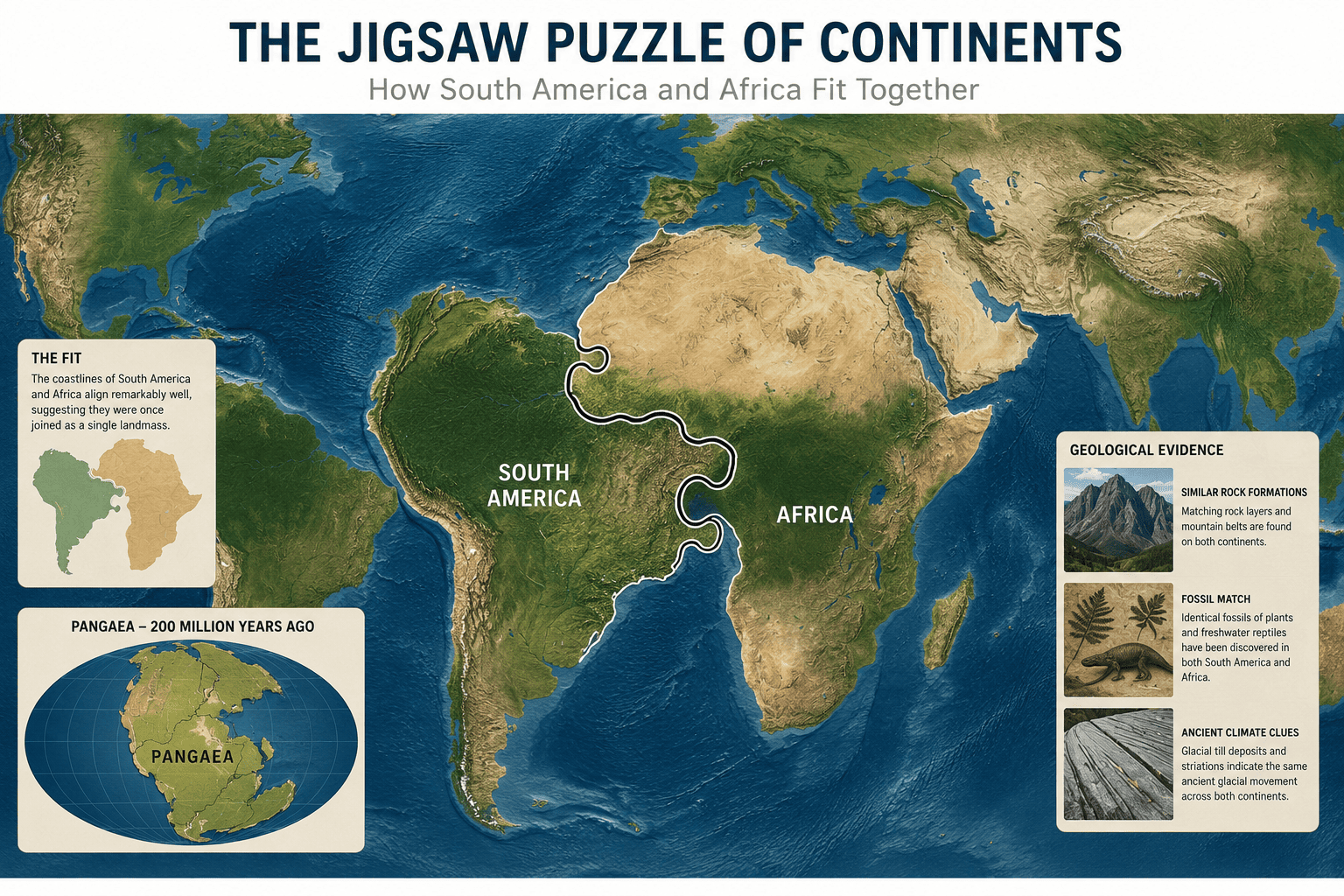
Imagine tearing a large jigsaw puzzle into several pieces and scattering them across a room. Even after years have passed, someone looking carefully at those pieces could still recognize that they once fit together. Wegener saw something remarkably similar when he studied a world map. The eastern coastline of South America appeared to match the western coastline of Africa with surprising precision. It was not a perfect fit—millions of years of erosion, deposition, and changing sea levels had altered the coastlines—but the resemblance was too striking to ignore. When scientists later compared the edges of the continental shelves beneath the oceans instead of the modern shorelines, the match became even more convincing. One matching coastline could be dismissed as coincidence. But when several continents appeared to complement one another like scattered puzzle pieces, the possibility that they had once been connected became difficult to overlook. Still, Wegener understood that coastlines alone could not prove his theory. He needed stronger evidence.
Rocks That Tell the Same Story
Rocks are far more than lifeless pieces of Earth's crust. To a geologist, they are pages from an ancient history book. When researchers compared rock formations on continents separated by oceans, they discovered something remarkable. Rocks of the same age, composition, and geological structure appeared on opposite sides of the Atlantic Ocean. Mountain belts in eastern North America aligned with those in Scotland and Scandinavia, while similar rock sequences were found in parts of Africa and South America. This wasn't simply a matter of rocks looking alike. These formations had formed during the same geological periods, experienced similar tectonic events, and shared nearly identical mineral compositions. Explaining such close similarities became increasingly difficult if the continents had always been thousands of kilometers apart. The simpler explanation was that these rocks had once been part of the same continuous landscape before the continents drifted away from one another.
Fossils That Could Never Cross an Ocean
Perhaps the most compelling evidence came from fossils. Imagine discovering the remains of the same extinct animal on two continents separated by a vast ocean. If that animal could neither swim across thousands of kilometers of seawater nor fly, how could its fossils appear in both places? This was exactly the mystery Wegener encountered. Fossils of ancient organisms such as Mesosaurus, a freshwater reptile, were found in both South America and Africa. Because it lived in rivers and lakes, crossing the Atlantic Ocean would have been impossible. Similarly, fossils of the seed fern Glossopteris appeared across South America, Africa, India, Antarctica, and Australia. Other extinct reptiles, including Lystrosaurus and Cynognathus, also showed surprisingly similar distributions. Instead of imagining impossible migrations across oceans that did not yet exist, Wegener proposed a far simpler explanation: these continents had once been joined, allowing plants and animals to spread freely before the landmass split apart. The fossils were not isolated discoveries. Together, they formed a pattern that strongly supported the existence of a former supercontinent.
Ancient Glaciers in Unexpected Places
Another clue came from Earth's ancient climate. Today, countries such as India, South Africa, and Australia contain regions with warm or temperate climates. Yet scientists discovered glacial deposits and scratches carved into ancient rocks in these very places. Such markings are produced when massive glaciers slowly move across the land, scraping and polishing the rocks beneath them. How could glaciers have once covered regions that are now far from the polar ice caps? If each continent had always occupied its present location, the evidence seemed difficult to explain. Wegener argued that these southern continents were once united as part of Gondwanaland, positioned much closer to the South Pole. As the continents gradually drifted northward over millions of years, the glaciers disappeared, but the marks they left behind remained preserved in the rocks. In this way, ancient climate itself became evidence that continents had changed their positions through time.
Placer Deposits: Geological Clues Hidden in Minerals
Not all evidence came from fossils or rocks. Some clues were hidden within valuable minerals. Heavy minerals such as gold are transported by rivers and eventually accumulate in specific locations, forming what geologists call placer deposits. These deposits develop under particular geological conditions and often remain preserved for millions of years. Scientists noticed that several placer deposits on continents now separated by oceans displayed striking similarities in age, composition, and geological setting. When viewed independently, these deposits might seem unrelated. But when the continents were reconstructed into their ancient positions, many of these mineral belts aligned surprisingly well. Like matching pages from the same book found in different libraries, these deposits suggested that the continents had once shared a common geological history before drifting apart. By the time Wegener assembled all these observations—the matching coastlines, identical rock formations, shared fossils, ancient glacial evidence, and corresponding mineral deposits—the idea of a former supercontinent no longer rested on a single clue. It was supported by multiple independent lines of evidence, each pointing toward the same conclusion. Yet one important question remained unanswered.
If the continents really moved across Earth's surface, what force was powerful enough to move something as enormous as a continent?
How Did Wegener Think the Continents Moved?
By the time Alfred Wegener had presented his evidence, he had convinced many scientists that the idea deserved attention. But there was one question that every supporter and critic eventually asked:
If continents really move, what is powerful enough to move them?
Finding matching coastlines, identical rocks, and similar fossils was one thing. Explaining the force capable of shifting continents thousands of kilometers across Earth's surface was something entirely different. Wegener believed that two natural forces were responsible for this movement. The first was the pole-fleeing force. Because the Earth rotates, Wegener suggested that this rotation created a force that slowly pushed continents away from the poles toward the equator. He imagined that, over millions of years, this force could gradually move enormous landmasses across the planet. The second was the tidal force generated by the gravitational pull of the Moon and the Sun. Since these celestial bodies constantly exert forces on Earth, Wegener proposed that their repeated pulling action might slowly drag the continents through the oceanic crust. At first glance, the idea sounded reasonable. After all, we witness tides every day, and we know that Earth's rotation influences many natural processes. However, science demands more than a plausible explanation—it demands evidence that the explanation actually works. As geophysicists examined Wegener's proposed forces more closely, they reached an uncomfortable conclusion. Both forces were far too weak. The pole-fleeing force simply did not generate enough energy to move continents weighing trillions of tonnes. Likewise, although tidal forces can raise and lower ocean levels by several meters, they are nowhere near powerful enough to drag entire continents across the Earth's surface. This became the greatest weakness of the Continental Drift Theory.
Why Many Scientists Rejected the Theory
Ironically, most scientists did not reject Wegener because of his observations. The coastlines really did resemble puzzle pieces. The fossils genuinely matched across continents. The rock formations, glacial deposits, and mineral belts were real discoveries that anyone could verify. What they rejected was the mechanism. Science is not satisfied with saying something happened. It also seeks to understand how and why it happened. Wegener had assembled an impressive collection of evidence suggesting that continents had once been united, but he could not provide a convincing physical process capable of moving them. As a result, many geologists dismissed the Continental Drift Theory. Some considered it imaginative but unproven. Others argued that continents were simply too massive to move at all. For several decades, Wegener's revolutionary idea remained widely rejected by scientists for several decades. Sadly, Alfred Wegener never lived to see his theory accepted. He died in 1930 during an expedition to Greenland, long before the scientific evidence needed to support his central idea was discovered.
The Missing Piece Was Found Decades Later
Science often advances in unexpected ways. Sometimes a theory is rejected not because it is wrong, but because the technology of the time cannot fully explain it. That is exactly what happened to Wegener's idea. During the mid-twentieth century, scientists began exploring the ocean floor in unprecedented detail. They discovered vast underwater mountain ranges, deep ocean trenches, and evidence that entirely new oceanic crust was continuously forming beneath the seas. These discoveries revealed that the Earth's surface was far more dynamic than anyone had previously imagined. Further research showed that heat rising from deep within the Earth's mantle creates convection currents—slow-moving circulations of hot and cool rock that act like a gigantic conveyor belt beneath the crust. These currents provide the driving force that moves massive pieces of the Earth's outer shell. Scientists also discovered the process of sea-floor spreading, demonstrating that new oceanic crust forms at mid-ocean ridges and gradually pushes older crust away. This explained how oceans grow wider and how continents can slowly drift apart over millions of years. Finally, these discoveries were brought together under the modern Plate Tectonic Theory, which showed that Earth's lithosphere is divided into several large and small tectonic plates. Rather than continents plowing through oceanic crust, both continents and ocean floors move together as parts of these plates. In other words, Wegener was wrong about the mechanism, but remarkably right about the outcome.
His greatest contribution was not explaining every detail, it was asking a question that forever changed our understanding of the Earth.
Conclusion
Today, the idea that continents move is no longer controversial. Satellites equipped with high-precision GPS can measure the motion of tectonic plates to within millimeters each year, confirming that the continents are still drifting even now. What began as a curious observation of matching coastlines eventually transformed our understanding of the Earth. Alfred Wegener looked beyond the map that everyone accepted and imagined a world where continents were not permanent, but travelers on a planet that is constantly changing.
The Continental Drift Theory reminds us of an important lesson about science. A great scientific idea does not always begin with complete answers. Sometimes it begins with a simple observation, a willingness to question what everyone else takes for granted, and the courage to follow the evidence wherever it leads. We often look at a world map as a finished portrait of our home, a permanent foundation beneath our feet. It is human nature to trust the ground we stand on. Yet, Continental Drift teaches us that our current map is nothing more than a single frame in a geological movie that has been running for billions of years. Even now, as you read this, the Earth is restless. The Atlantic Ocean is steadily growing wider, pushing the Americas away from Europe and Africa. The Himalayas are still rising as India continues its slow-motion collision into Asia, and the African continent is slowly tearing itself apart along the East African Rift.
Millions of years ago, the Earth was united as Pangaea, surrounded by the immense Panthalassa. Today, those ancient lands are scattered across the globe as separate continents. But their journey is far from over. If we could fast-forward another 250 million years, we wouldn't see the seven continents we know today. We would likely see them colliding once again, forging a new, unrecognizable supercontinent. It is a profoundly humbling thought: humanity inhabits this planet for only a fraction of a second in geological time, yet through sheer curiosity and observation, our minds have managed to peer deep into the past and envision the distant future. The map will keep changing, mountains will rise and fall, and oceans will open and close, but the story of Earth carries on, written in the slow, relentless drift of the world beneath us.
Narendra Dwivedi
Author